
Transportation Engineering — Geometric Design
Plan, profile, and cross-section: align the road so vehicles can steer, see, and stop safely.
Introduction
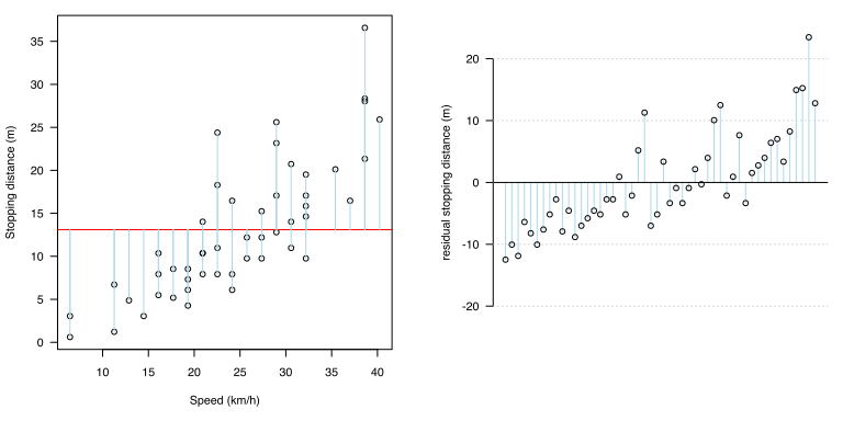
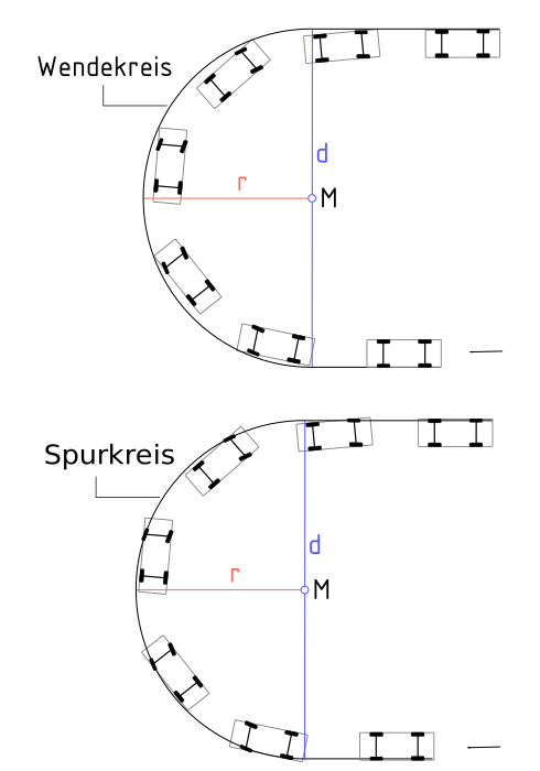
Geometric design fixes the path of the roadway in plan (straights, curves, transitions) and profile (grades, vertical curves), together with lane width, crossfall, and clear zones. Stopping sight distance (SSD) combines reaction distance and braking distance; passing and decision sight distances are longer in many standards. Horizontal curves use radius and superelevation; intersections need turning paths and channelisation compatible with design vehicles.


What geometric design fixes
- Alignment — curvature, transition lengths, and design speed consistency.
- Vertical geometry — grades, crest and sag curves for sight and drainage.
- Cross-section — lanes, shoulders, medians, slopes, and clear width for recovery.
- Interfaces — intersections, ramps, and terminal layouts for design vehicles.
Standards and guidance (South Africa)
National roads: SANRAL TRH series for geometric layout and sight distance. Other roads: COLTO and provincial or municipal manuals. Coordinate with traffic engineering (volumes, LOS) and safety audits; sight distance requirements often govern crest curves and barrier offsets.
Notation (common)
- V — design or operating speed (km/h in the calculator).
- t — perception–reaction time (s).
- a — longitudinal deceleration (m/s²).
- R — curve radius; e — superelevation (in detailed design).
Examples in practice
- Rural highway: SSD and passing sight on straights and crest curves.
- Urban arterial: lane width, median openings, and intersection corner radii for buses and trucks.
- Roundabout: entry deflection and inscribed circle for design vehicle swept path.
- Mountain pass: limiting gradient and emergency stopping sight past tight curves.
Calculator — stopping sight distance
Enter V (km/h), t (s), and a (m/s²). Speed is converted with v = V/3.6 m/s; output is approximate SSD in metres (level road, no grade correction).
SSD
Stopping sight distance SSD = vt + v²/(2a) from design speed, reaction time, and deceleration (level road).
Key terms
- Sight distance
- Distance visible ahead for stopping, passing, or decision—must exceed required values for design speed and context.
- Design vehicle
- Vehicle dimensions used to check lane width, turning radii, and swept paths.
Software and geometric design
Road projects combine alignment, profiles, cross-sections, and corridor models. Examples (official sites):
- Autodesk Civil 3D — alignments, profiles, corridors, and superelevation.
- OpenRoads Designer — road and corridor design (Bentley).
- ArcGIS Pro — GIS context, terrain, and preliminary corridor siting.
- PTV Visum — transport planning networks (links demand to geometric options).
No product endorsement—confirm design inputs, design vehicles, and sight checks against the governing standard and independent checks where required.
Diagram sources
Educational figures. Files in Images/geometric-design/ were downloaded from Wikimedia Commons into this repo (not copied from other topic folders). Confirm licence on each Commons file page before reuse.